
Redford Neighbors by Block
Records around a Redford address answer different questions. The map establishes which parcels physically touch. The assessment record identifies an owner or taxpayer and the parcel’s mailing and situs fields. Recorded deeds provide a transaction trail. Michigan’s voter tool can only confirm a specific person through a person-first search. Township association information identifies a named neighborhood and a contact path, not its members. Treat each result as a dated clue rather than a complete roster of nearby people.
| Source | What It Shows About a Block | Access |
|---|---|---|
| Wayne GIS ParcelViewer | Adjacent parcel polygons, address, ZIP, and mapped owner attributes | Public map or REST service |
| Redford BS&A | Parcel owner or taxpayer, situs, mailing, tax, and assessment facts | Per-parcel public search with fee/disclaimer |
| Wayne land records | Instruments and named parties tied to a legal description | Free name index, paid images, counter or mail for older material |
| Michigan.gov/Vote | A person-specific public voter match | No street sweep; protected fields excluded |
| Neighborhood associations | Official boundary descriptions and limited contact information | Township page; no member-name directory |
| RTDL and Historical Commission | Older block names, maps, directories, and newspaper context | Digitized and in-person historical collections |
An owner can receive tax mail somewhere else, and a parcel map cannot identify every occupant. The block method is strongest when it preserves that difference between legal property evidence and information about people.
Redford Neighbors on Parcel Maps
Wayne County ParcelViewer supplies parcel geometry and attributes that include a mapped owner field, street, ZIP, full address, and parcel-related fields. Pan and zoom to the address until the parcel boundaries are visible. The important fact is physical adjacency: use the touching polygons rather than guessing from house-number order, an alley, or a street name.
The service supports geometry, distance, and query functions, but the reviewed interface did not verify a visible buffer or radius control. Do not promise one. The safe method is to select the target polygon, read its attributes, and visually identify the polygons that touch it. A mapped owner attribute connects a name to a parcel record, not to a statement that the building is occupied by that person.
The Wayne County ParcelViewer service is shown below.
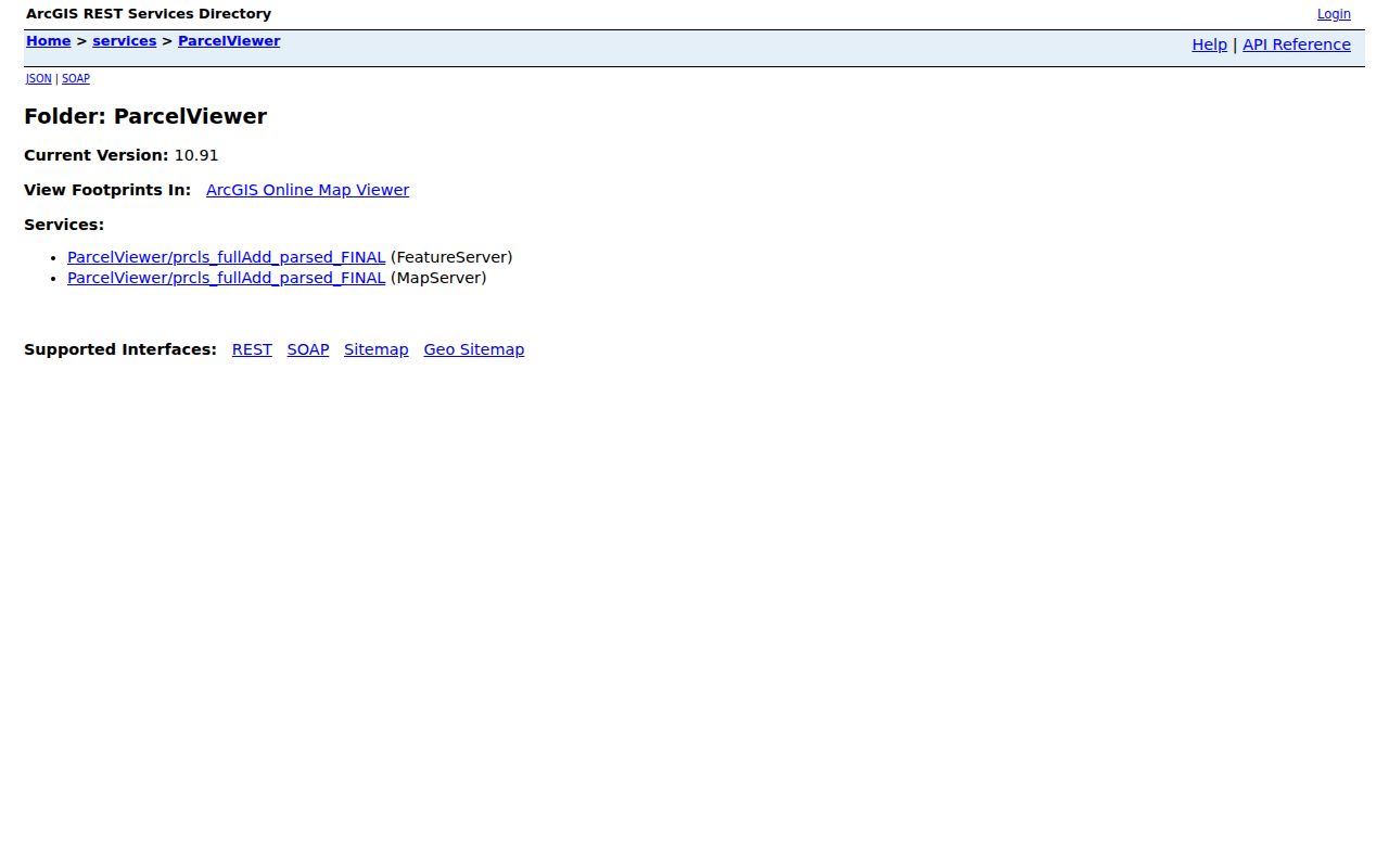
Use the visible parcel edge and source date when recording a nearby lot, especially where streets, alleys, or similar house numbers create ambiguity.
Trace Redford Neighbors by Parcel
Start with one complete address, then build a compact block table rather than a name list. Each row should identify the target or adjacent parcel, full address, parcel ID, mapped owner field, situs ZIP or city, assessor-check status, deed-check status, and the date the information was read. That recordkeeping step prevents a same-number street or a nearby parcel from becoming an accidental match.
- Locate the target address in the Wayne GIS service and note its full address, OBJECTID, parcel-related fields, and visible polygon.
- Identify only polygons that touch the target and record each adjacent parcel or full address.
- Carry each parcel or address to Redford BS&A, preserving the owner or taxpayer, situs, and mailing fields separately.
- When a transaction question remains, search the mapped name and legal description at Wayne County Land Records.
- Stop at the immediate block. For a whole named street and its full record chain, use the Redford street directory.
BS&A data can show property class, values, transfer indicators, exemptions, and characteristics in addition to a name. A mailing address can suggest where tax correspondence goes, but it does not establish who is present on the parcel. The assessor office is the local route when portal information needs procedural help; nonexempt administrative records may also have a FOIA request path.
Redford Neighbor Parcel Details
The parcel-address layer behind the county map can be queried for its geometry and fields. It is read-only and has a maximum response of 1,000 records, which matters when someone tries to broaden a block task into a large extraction. A bounded address-by-address check is more accurate and better suited to the actual public tools. It also makes room to verify a locality mismatch before choosing a township record.
Wayne County’s parcel address layer displays the data service used for parcel geometry and address attributes.
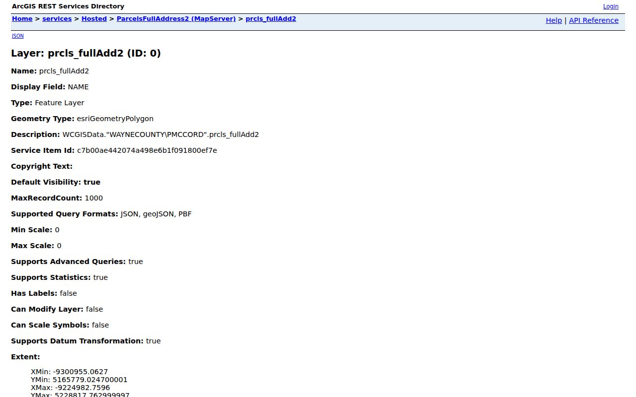
The capture documents the service, not a rendered neighbor list. The research did not verify a public block export or a selectable GIS radius tool.
Note: Preserve both the physical situs and mailing field before using any parcel result as a person lead.
Redford Neighbors and Associations
Redford Township’s neighborhood-association page publishes association names, boundary descriptions, and limited contact status. It does not publish membership rosters. The names are still useful geographic labels when a parcel falls within an official neighborhood, and the Township Clerk is the contact route for association information or starting an association.
The official inventory separates active boundary information from a published contact. “Contact needed” means the township page does not provide a public association contact, not that a roster can be requested.
| Association | Boundary or published contact | Directory status |
|---|---|---|
| Grand Dale | Beech Daly to Inkster; West Chicago to Plymouth | Contact needed; no member list |
| Grand Dale Gardens | Beech Daly to Telegraph; West Chicago to Plymouth | Contact needed; no member list |
| Hazelton Block | Meadow Park and Joy Road; Gwendolyn Lewis, 313-467-9294 | Published contact; no member list |
| Plymouth Road | Business-owner group | Listed as no longer active |
| Rogers Park | Grand River to Eight Mile; Beech Daly to Five Points | Contact needed; no member list |
| Telegraph Hazelton | Telegraph-Hazelton; Plymouth-Joy | Contact needed; no member list |
| Western View | Schoolcraft to Western Golf Course; Maurice Peete, 313-534-7426 | Published contact; no member list |
| Jefferson | Inkster to Beech Daly; Joy to West Chicago | Contact needed; no member list |
| Brady | I-96 to Glendale | Contact needed; no member list |
| Western Heights | South of Five Mile; Inkster to Meadowbrook | Contact needed; no member list |
The township association listing is pictured below. It is a boundary and contact resource, not a source for naming residents on a block.
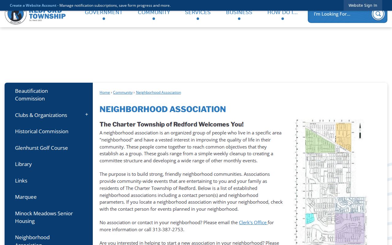
Call the Township Clerk at 313-387-2753 for association information. The Board and Commissions material names a Neighborhood Associations Council but does not supply a member-name roster.
Redford Neighbors and Voter Data
Michigan.gov/Vote is useful only after a person’s name, birth month, and birth year are known. The public tool does not sweep a street or return all voters near an address. Michigan law allows inspection of registration records, but the public-confidential split remains important: full birth data, driver-license or state-ID information, Social Security number, phone, email, and protected address details are not ordinary public fields.
A full voter-file request form, fee, and format were not verified in the research. Ask the Secretary of State or Redford Clerk about permissible fields, redactions, format, and use rules if a lawful need exists. Never call a block complete because one or two person-first searches return names. Ballot choices are secret and do not belong in a neighbor search.
Redford Neighbor Geography
Local history can add context without manufacturing a current roster. Redford Township District Library’s archive includes newspapers, yearbooks, a 1925 Polk directory, and local death records. The Historical Commission holds maps, neighborhood-watch binders, Old Homes material, property abstracts, house field sheets, and newspapers. Those sources can help explain an old block name, a structure, or a dated community connection. They should be cited with the year and source rather than treated as current-person evidence.
The township’s recorded neighborhood names are more useful than a generic “Redford neighborhood” label. Redford’s Detroit-adjacent geography matters too: a ZIP or city label alone can cross a jurisdictional boundary. These distinctions are especially useful when an older street name or city label has changed. Check the physical parcel before assuming the township assessor or 17th District Court is the right custodian.
For a reported public condition near the block, Redford’s Clemis route is a general date, location, and crime-type search, not a detailed name source. A permit, code, or administrative record has no verified public case portal; use a focused written request for nonexempt records instead of guessing what exists.
Check Redford Neighbor Sources
Official property and association sources have clear limits, but they show where a result came from. Compiled commercial neighbor reports may combine property, directory, and marketing data. Those reports can be stale, duplicate an address, or connect similar people incorrectly. They cannot prove parcel adjacency or household membership. Use the parcel map, assessment record, and official association contact to verify a claim.
| Official record path | Compiled commercial category |
|---|---|
| Shows a custodian, parcel, map geometry, field, or dated filing. | May combine records from different dates and sources. |
| Supports a limited claim about property, an address, or an association boundary. | Can suggest a lead but does not establish who occupies a location. |
| Can be checked with the responsible office or source date. | Must be checked against the actual custodian record. |
Redford Neighbors and Privacy
Many details about a block are not public. Parcel records do not identify every household member. Utility customers, delivery records, DMV addresses, unlisted contact details, protected voters, Address Confidentiality Program addresses, sealed court parties, and nonpublic vital information remain private. A substitute or absent address cannot be used to infer where someone actually lives.
Michigan’s Address Confidentiality Program provides eligible participants a substitute address and mail forwarding. Other court, vital, and probate restrictions operate separately. Keep public names and addresses to the minimum needed for a legitimate personal question, retain the source date, and direct a correction issue to the office that holds the record.
Lawful use. Use information about nearby people for personal research, civic curiosity, reconnecting, or a safety concern. Public records do not permit stalking, harassment, intimidation, surveillance, or repeated unwanted contact.